February 3, 2015 7:42 AM
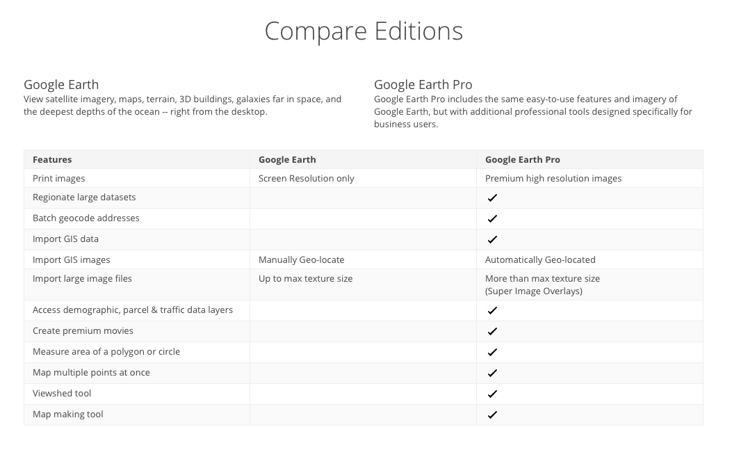
Google announced last Friday that they were going to start offering their Pro version of Google Earth at no cost. The Pro version was meant mainly for developer, architects, contractors and real estate agencies who need both more advance measuring tools than the basic version offered plus higher resolution printouts.
Here is a table showing the differences between the two versions.
Unlike with the free version the Pro version allows you to measure diameters, heights and 3D paths and polygons.
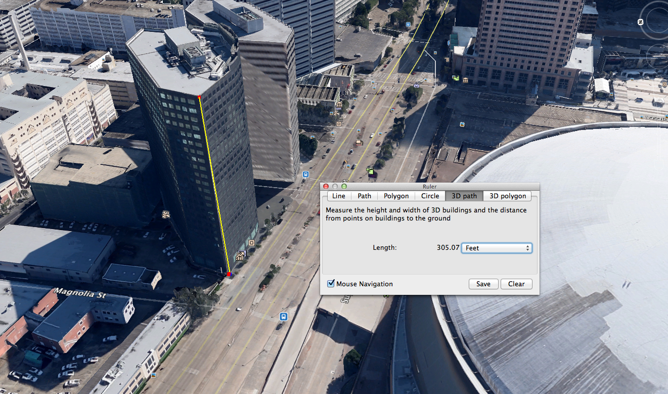
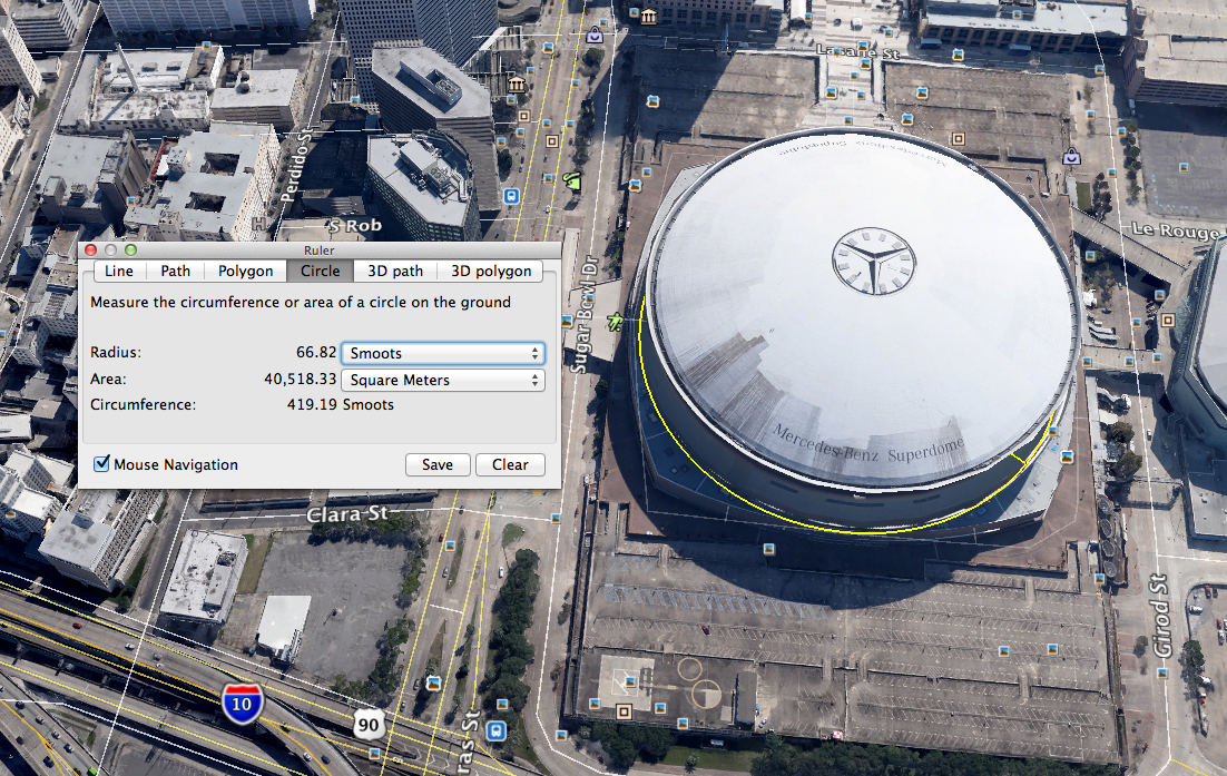
I decided I’d test the measuring tools on something small to test the accuracy. I zoomed over to Colonial Williamsburg Courthouse which I built the model of years ago based on HABS surveys. The footprint measured out to be accurate within 99% and the height to within 98% accuracy. That’s pretty amazing.
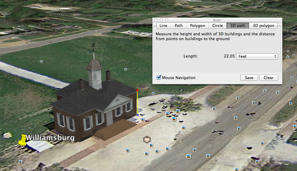

You can download the model here and check the results for yourself.
Posted by rdwilkins
Categories: Art Department, Reference, Software, Technology, Tools
Tags: 3D design, 3D modeling, design, Google Earth, Google Earth Pro, location survey, measuring tools, real estate agencies, software, technology, tools
Mobile Site | Full Site
Get a free blog at WordPress.com Theme: WordPress Mobile Edition by Alex King.
[…] 2/2/2015 – In a recent post I mentioned that Google Earth Pro is now available as a free version. Most building heights can be […]
LikeLike
By Estimating Building Heights Using Sketchup & Google Earth | on February 3, 2015 at 8:20 AM